New council map reflects population shifts

November 19, 2012 By Raanan Geberer Brooklyn Daily Eagle
map redistricting 1540.png
Share this:

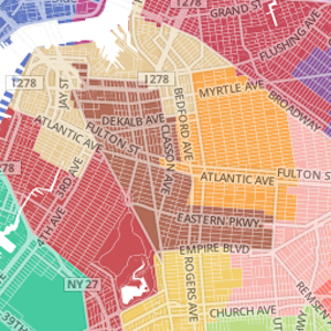
The new City Council redistricting plan doesn’t have any radical changes in Brooklyn’s district lines, but those changes that are proposed are significant nevertheless.

The City Council district maps are redrawn every 10 years to reflect new realities revealed by the census. The new map was unanimously approved by the council’s redistricting commission last week following a series of hearings in every borough. 

The website of the official city radio station, WNYC, has a map that shows both the existing districts and the proposed new districts. 

Subscribe to our newsletters

One change which, according to Bay Ridge and Dyker Heights residents, is long overdue, would be seen in the 43rd Council District, represented by Vincent Gentile. 

The boundaries are basically the same, but they now include a large, jagged former “cut-out” in Bath Beach that wasn’t included in the past.

“That part of Bath Beach,” said a spokesman for Gentile, “was formerly represented by Staten Island Councilman James Oddo. That made no sense at all.”

The spokesman added that Bay Ridge residents had hoped that the Bay Ridge Towers, around 65th Street, would be added to the district, but they are still part of the 27th C.D. (Sunset Park-Red Hook), represented by Sara Gonzalez.

The 33rd C.D., represented by Councilman Steve Levin, in Northwest Brooklyn, will lose most of its Park Slope “territory” to the 39th C.D. (Carroll Gardens/Park Slope/Kensington), represented by Brad Lander.

“Park Slope had been split between the two districts,” said a spokesperson for Levin. “The 33rd had gained a lot of population since the last census,” especially in Williamsburg, where there has extensive waterfront condo development.

Therefore, the Park Slope territory was given to the 39th to even out population densities.

The 48th C.D. (Gravesend-Coney Island-Brighton) lost a substantial amount of territory on its northern end, which stretched almost as high as the “junction” between Flatbush and Nostrand avenues. 

That district is currently represented by Councilman Domenic Recchia. However, he will soon be “term-limited” out of the Council, according to a spokesperson for Recchia.

Andrew Beveridge, professor of sociology at Queens College, told WNYC “the map will likely not change the way the city is governed nearly as much as term limits.” His analysis showed that a typical district, under the new map, retained 87 percent of the population of the former map.


Leave a Comment


Leave a Comment